Cities in India

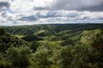
Cherapunjee, India
Nestled in the heart of Meghalaya, Cherapunjee is a misty paradise shrouded in lush greenery, where the sweet scent of orchids and the sound of gushing ... more
Mawsynram, India
Mawsynram is a village in the East Khasi Hills district of Meghalaya state in north-eastern India, 65 kilometers from Shillong. Located in Mawsynram, is a cave ... more

Tawang, India
Nestled in the Himalayas, Tawang is a serene Buddhist town surrounded by snow-capped mountains, pristine lakes, and lush forests. The scent of incense wafts ... more
Aalo, India
Aalo, formerly Along, is a census town and headquarter of the West Siang district district of the Indian state of Arunachal Pradesh. It is located 220 ... more

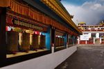
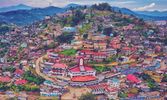
Itanagar, India
tanagar is the capital of Arunachal Pradesh which is dotted with archeological sites of great historical value. There are also institutions of great socio-... more

Anini, India
Anini is the headquarters of the Dibang Valley district in the state of Arunachal Pradesh in Northeast India. Anini was also the district headquarters of the ... more

Khonsa, India
Khonsa is the headquarters of Tirap district in the Indian state of Arunachal Pradesh. It also houses Ramakrishna Sarada Mission School, Christ The King ICSE ... more
Daporijo, India
Daporijo is a census town in the Upper Subansiri district, Indian state of Arunachal Pradesh in the Northeast of India. Daporijo is located at an elevation of... more
Bhalukpong, India
Nestled in the Himalayan foothills, Bhalukpong is a serene getaway in Arunachal Pradesh. This picturesque town is surrounded by lush forests, rolling hills, and... more
Bomdila, India
Perched amidst the majestic Himalayas, Bomdila is a tranquil retreat in Arunachal Pradesh, India. This picturesque town is wrapped in lush green forests, with ... more

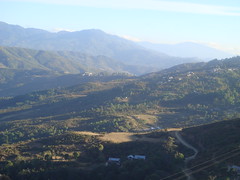
Dirang, India
Nestled in the Himalayan foothills, Dirang is a serene valley town surrounded by lush green forests, gurgling rivers, and majestic mountains. The sweet scent of... more

Along, India
Aalo is a census town and headquarter of the West Siang district of the Indian state of Arunachal Pradesh. It is located about a days drive 220 kilometres (140 ... more

Pasighat, India
Pasighat is the headquarters of East Siang district in the Indian state of Arunachal Pradesh. Situated at 155 meters, with its scenic splendours, Pasighat is ...

Tezu, India
Tezu is a census town and the headquarters of Lohit district in the Indian state of Arunachal Pradesh. The ancient inhabitant of this land of valley and rivers ... more

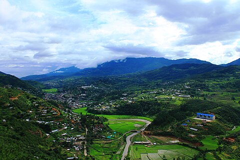
Ziro, India
Ziro is a census town in Lower Subansiri district in the Indian state of Arunachal Pradesh . It has been a favorite town for World Heritage Site for a... more
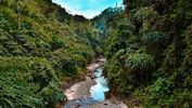
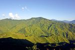
Namdapha National Park, India
Namdapha National Park is the largest protected area in the Eastern Himalaya biodiversity hotspot and is located in Arunachal Pradesh in Northeast India. It is ... more

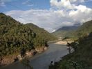
Roing, India
It is a picturesque town in a valley by the side of the Dibang River. Nehru Van Udyan, a beautiful forest park on the riverbank at Deopani has a well maintained... more
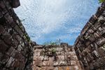
Imphal, India
Imphal City is the capital of the Indian state of Manipur. The ruins of the old Palace of Kangla are located in the heart of the town, surrounded by a moat. ... more
Chandel, India
Chandel is a City in Chandel District of Manipur State, India. Chandel is surrounded by Sangaikot Tehsil towards west , Chakpikarong Tehsil towards South , ... more
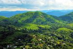
Ukhrul, India
Ukhrul is a district in the north eastern state of Manipur in India . It lies about 84 kilometres (52 mi) north east of Imphal. The village of Shirui is ... more
Thoubal, India
The district of Thoubal, which occupies the bigger portion of the eastern half of the Manipur Valley, takes the shape of an irregular and triangular with its ... more
Tamenglong, India
Tamenglong is the district headquarters of Tamenglong district in the state of Manipur in India. The northeastern block of India comprises seven states, ... more
Senapati, India
It is the district headquarters of the northern hill district Senapati on the National Highway No. 39. Some historical places which are unique in itself and ... more

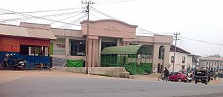
Bishnupur, India
Bishnupur is a town and a municipality in Bankura District in the state of West Bengal, India. It is famous for its terracotta temples and the balucheri sarees
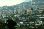
Kohima, India
Kohima is the hilly capital of India's north eastern border state of Nagaland which shares its borders with Burma. It lies in Kohima District and is one of the... more
Mon, India
Mon is a town and a town area committee in Mon district in the Indian state of Nagaland. Mon is the land of the captivating Konyak Nagas, whose culture and ... more
Mokokchung, India
Mokokchung is a town and a municipality in Mokokchung district in the Indian state of Nagaland. It is the district headquarters as well as the main urban hub of... more
Phek, India
Phek is a district of Nagaland state, India. It was established in 1973. The district headquarters are in the town of Phek. Phek district is a mountainous ... more

Tuensang, India
Tuensang is a town in Nagaland, India. It is the headquarters of the Tuensang district, the easternmost and the largest district of Nagaland, bordering with ... more
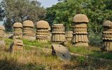
Dimapur, India
Dimapur is the largest city in Nagaland, India. In the Middle Ages, it was the capital of the Dimasa Kachari rulers. In the heart of the town there is an old ... more